
Today’s Wonder of the Day was inspired by Sara from Mundelein. Sara Wonders, “Where does the idea of private property come from?” Thanks for WONDERing with us, Sara!
Where in the world are you? Have you ever given that question much thought? Of course, you can probably name the city, state, and country you’re in. But how do you know exactly where you are within that city?
Let’s say you’re in your local park. The park itself is probably really easy to find. There might even be a sign that lists the park’s name and the rules to follow while you're there. But where does the park end and the next property begin?
If there’s a fence, it might be easy to define that spot. But most properties—public or private—don’t have fences all along their boundaries. So how do you know where they are? Does it even really matter?
In many cases, yes. Many neighbors might not mind if you cross over into their yards once in a while. However, the entire system of property ownership relies on knowing where the boundaries are.
What if you one day buy or sell a piece of land? You’ll need legal documentation of the property. This includes its exact dimensions and boundaries. That means you’ll need help from someone trained to determine those things. Who are we talking about? A surveyor, of course!
Land surveyors establish official boundaries on land, in the air, and on bodies of water. They use their skill in science, math, and technology to do so. Most land surveyors spend lots of time outside. Many also have offices where they work on research and reports.
Who might request the work of a land surveyor? Their services are often needed by civil engineers, construction managers, architects, and real estate attorneys. All of these jobs need to know the set boundaries of different properties for their work.
How does a land surveyor do their job? They’ll usually start with research. They use the Internet, old maps, and official records to learn everything they can about the land in question. Then, the surveyor will head out into the field to confirm the boundaries and measurements.
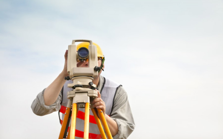
A surveyor’s work in the field could involve lots of walking and climbing. They do so while carrying a number of tools. They may bring a theodolite and steel band, a total station, a level, and a GPS surveying system. Most, if not all, of these tools, can be mounted on a tripod. This helps a surveyor get precise measurements. In the field, a surveyor will often use established reference points, known as benchmarks. These establish boundaries based on their relative positions.
Would you like to be a surveyor one day? If you enjoy both research and spending time outside, it could be a good fit for you! The job surveyors do for both public and private land is important for us all.
Standards: CCRA.L.3, CCRA.L.6, CCRA.R.1, CCRA.R.2, CCRA.R.4, CCRA.R.10, CCRA.SL.1, C3.D2.Geo.2,

