
Today’s Wonder of the Day was inspired by Kaya. Kaya Wonders, “How do you read a map?” Thanks for WONDERing with us, Kaya!
Do you look forward to growing up? If you’re like most kids, you probably dream of the day when you can do all the things adults do. At first, it might be the cool rides at the amusement park that you have to be a certain height to ride.
Later, though, it’s a different ride you’re probably dreaming of. That’s right. We’re talking about your very own car that you can drive wherever you want. Where do you dream of going one day on your own?
Wherever it is you’d like to go, you’ll need to know how to get there. As your parents ferry you around from place to place when you’re young, you might not pay much attention to where you’re going. You get in, you read or play with your electronic devices, and then you magically arrive at your destination.
Most kids don’t think much about exactly how they get from Point A to Point B during a trip. One day, though, you’ll need to know some basic skills to keep from getting lost or being late.
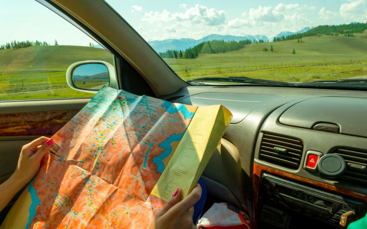
If you’re a technologically-savvy kid, you might think that all you’ll need is the Global Positioning System (GPS) app on your smartphone. This can certainly help you get where you want to go. But what if your electronic services fail? What if your phone can’t get a signal? You’ll want to make sure you have the skills to read a good, old-fashioned, paper map.
Paper maps come in all sorts of shapes, sizes, and colors. They can cover a large area, such as a globe that shows the entire Earth. Or they can cover smaller areas, such as a country, state, or city. Some maps even cover the smallest details of the trails that cut through a small section of forest.
If you’ve ever looked at a paper map, you may have noticed it was covered in lines and symbols. What do all of these mean? How do people read maps and understand how to get from Point A to Point B? To get started with a paper map, the first step is to look at the legend.
The legend is also called the key. It will tell you basic information about what all the symbols on the map mean. For example, the legend might indicate that dashed lines are borders between counties. It may tell you that thick, red lines indicate interstate highways.
After becoming familiar with the map‘s legend, you’ll want to check its orientation and scale. Most maps feature an orientation with north at the top of the map. This helps you determine the direction you must travel to get where you want to go.
A map’s scale tells you how distance on the map relates to distance in the real world. For example, a map might have a scale that uses one inch to indicate one mile. Using the scale, you can estimate that two cities that are five inches apart on the map are actually five miles apart.
Maps also use colors to communicate information. If you see an area on a map that’s blue, there’s a good chance it’s a body of water. Likewise, green areas are often forests, while white areas are regular land. With these basics in mind, you can use a paper map to help you figure out where you are and the best route to get you where you want to be.
Where might a paper map take you? Would you love to set out on a cross-country road trip? Or are you destined for the nearest beach? Maybe you can lead your family on a tour of beautiful national parks! Now that you know how to read one, the choice is yours!
Standards: C3.D2.Geo.2, C3.D2.Geo.3, CCRA.L.3, CCRA.L.6, CCRA.R.1, CCRA.R.2, CCRA.R.4, CCRA.R.10, CCRA.SL.1

